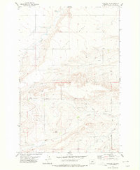
1978 Map of Stanford NE
USGS Topo · Published 1979About this map
Coyote Bench dominates the northern landscape of this region in Judith Basin Co., where high plains terrain meets a complex network of seasonal and perennial water sources. The map reveals a land defined by its hydrology and small-scale resource extraction during the late 1970s. Key water features like Walker Spring and the winding Coyote Creek illustrate the natural drainage patterns that have long shaped ranching and land use in this part of Montana.
Find a feature on this map
13 named features on this map. Tap any name to fly to it.
Don’t see what you’re looking for? This feature index may not catch every label — zoom into the map to look around manually.
Map Details
Editions of this 1978 Stanford NE Map
This is the sole edition of this map. No revisions or reprints were ever made.
Other maps of this area

1890 · Fort Benton
USGS Topo · 1:250,000

1892 · Fort Benton
USGS Topo · 1:250,000

1897 · Fort Benton
USGS Topo · 1:250,000

1954 · Great Falls
USGS Topo · 1:250,000

1954 · Lewistown
USGS Topo · 1:250,000

1957 · Great Falls
USGS Topo · 1:250,000

1959 · Lewistown
USGS Topo · 1:250,000
1970 · Moccasin
USGS Topo · 1:24,000
1970 · Big Spring
USGS Topo · 1:24,000
1978 · Benchland
USGS Topo · 1:24,000