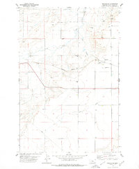
1978 Map of Benchland
USGS Topo · Published 1979About this map
Benchland serves as the central hub of this Central Montana landscape, situated along the Burlington Northern railroad line in Judith Basin. The settlement pattern reflects a mid-century agricultural economy, with numerous storage bins and gravel pits scattered across the terrain to support local operations. Significant watercourses like Sage Creek, Big Coulee, and Louse Creek carve through the topography, dictating the placement of roads and homesteads. Local genealogy is anchored by the Benchland Cem, while the inclusion of a Landing Strip and an extensive Pipeline underscores the evolving industrial and transportation infrastructure of the late 1970s. The map provides a clear look at the intersection of rail transport and rural life before modern consolidation changed many of these small-scale landmarks.
Find a feature on this map
13 named features on this map. Tap any name to fly to it.
Don’t see what you’re looking for? This feature index may not catch every label — zoom into the map to look around manually.
Map Details
Editions of this 1978 Benchland Map
This is the sole edition of this map. No revisions or reprints were ever made.
Other maps of this area

1886 · Little Belt Mts.
USGS Topo · 1:250,000

1889 · Big Snowy Mountain
USGS Topo · 1:250,000

1890 · Fort Benton
USGS Topo · 1:250,000

1892 · Fort Benton
USGS Topo · 1:250,000

1893 · Big Snowy Mountain
USGS Topo · 1:250,000

1894 · Little Belt Mts.
USGS Topo · 1:250,000

1897 · Fort Benton
USGS Topo · 1:250,000

1897 · Little Belt Mts.
USGS Topo · 1:250,000

1898 · Little Belt Mts.
USGS Topo · 1:250,000

1902 · Little Belt Mts.
USGS Topo · 1:250,000