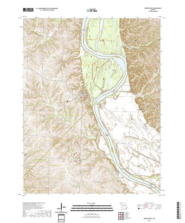
2021 Map of Arrow Rock
USGS Topo · Published 2021About this map
Arrow Rock stands as a prominent historical waypoint along the high bluffs overlooking the Missouri River, where the Lewis And Clark Trail of Discovery Trl and Pierre A'Efectte Trl meet the water. This 2021 survey documents the complex river geography of the Saline and Howard county border, defined by dramatic meanders such as Saline City Bend, Salt Creek Bend, and Slaughterhouse Bend. The landscape transitions from the river bottomlands of Jameson Island to the rolling uplands of the Blackwater R drainage.
Find a feature on this map
71 named features on this map. Tap any name to fly to it.
Don’t see what you’re looking for? This feature index may not catch every label — zoom into the map to look around manually.
Map Details
Editions of this 2021 Arrow Rock Map
This is the sole edition of this map. No revisions or reprints were ever made.
Other maps of this area

1887 · Sedalia
USGS Topo · 1:125,000

1888 · Boonville
USGS Topo · 1:125,000

1890 · Glasgow
USGS Topo · 1:125,000

1890 · Marshall
USGS Topo · 1:125,000

1892 · Marshall
USGS Topo · 1:125,000

1894 · Sedalia
USGS Topo · 1:125,000

1901 · Marshall
USGS Topo · 1:125,000

1940 · Marshall
USGS Topo · 1:62,500

1944 · Marshall
USGS Topo · 1:62,500

1947 · Glasgow
USGS Topo · 1:62,500