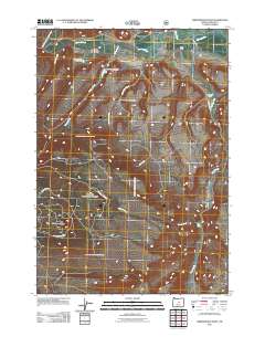
2011 Map of Arrowwood Point
USGS Topo · Published 2011About this map
The Crooked River and its North Fork define the northern drainage of this high-plateau landscape, where water management is centralized through a series of structures including Mainline Dam Number 1, Mainline Dam Number 2, and Mainline Dam Number 3. The terrain is characterized by the prominent elevation of Arrowwood Point in the southwest and a network of drainages such as Maury Creek and Cemetery Creek. Human presence is sparse and focused on established agricultural outposts like Glenn Ranch and Severance Ranch. This 2011 survey by the U.S. Geological Survey shows a remote corner of Central Oregon where transportation is facilitated by thoroughfares such as Maury Creek Rd and East End Rd, supporting a rural economy tied to the land and the strategic control of its seasonal water sources.
Find a feature on this map
20 named features on this map. Tap any name to fly to it.
Don’t see what you’re looking for? This feature index may not catch every label — zoom into the map to look around manually.
Map Details
Editions of this 2011 Arrowwood Point Map
This is the sole edition of this map. No revisions or reprints were ever made.
Other maps of this area

1951 · Post
USGS Topo · 1:62,500

1955 · Crescent
USGS Topo · 1:250,000

1955 · Bend
USGS Topo · 1:250,000

1957 · Crescent
USGS Topo · 1:250,000

1957 · Bend
USGS Topo · 1:250,000

1958 · Crescent
USGS Topo · 1:250,000

1958 · Bend
USGS Topo · 1:250,000

1970 · Crescent
USGS Topo · 1:250,000

1981 · Prineville
USGS Topo · 1:100,000

1982 · Arrowwood Point
USGS Topo · 1:24,000