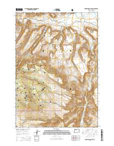
2014 Map of Arrowwood Point
USGS Topo · Published 2014About this map
The Crooked River and its North Fork carve through this high-desert landscape in Crook County, where the terrain is defined by dramatic volcanic features and remote drainages. Central to the area’s geography is the namesake Arrowwood Point, a prominent landmark that overlooks the southern reaches of the Ochoco National Forest. The map reveals a specialized water management system consisting of Mainline Reservoir Number 1, Number 2, and Number 3, likely supporting local land use in this arid environment.
Find a feature on this map
24 named features on this map. Tap any name to fly to it.
Don’t see what you’re looking for? This feature index may not catch every label — zoom into the map to look around manually.
Map Details
Editions of this 2014 Arrowwood Point Map
This is the sole edition of this map. No revisions or reprints were ever made.
Other maps of this area

1951 · Post
USGS Topo · 1:62,500

1955 · Crescent
USGS Topo · 1:250,000

1955 · Bend
USGS Topo · 1:250,000

1957 · Crescent
USGS Topo · 1:250,000

1957 · Bend
USGS Topo · 1:250,000

1958 · Crescent
USGS Topo · 1:250,000

1958 · Bend
USGS Topo · 1:250,000

1970 · Crescent
USGS Topo · 1:250,000

1981 · Prineville
USGS Topo · 1:100,000

1982 · Arrowwood Point
USGS Topo · 1:24,000