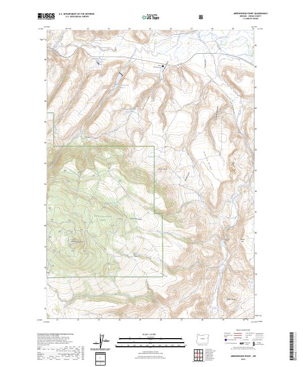
2023 Map of Arrowwood Point
USGS Topo · Published 2023About this map
The Maury Mountains rise across the center of this region within the Ochoco National Forest, defining a high-elevation landscape marked by steep ridges and isolated volcanic buttes. To the north, the terrain drops toward the Crooked River and its tributary, the North Fork Crooked River, where the SE Paulina Hwy follows the canyon floor. Water management is a central feature of the northern slopes, where a sequence of catchment basins — Mainline Reservoir Number 1, Mainline Reservoir Number 2, and Mainline Reservoir Number 3 — are positioned along Cemetery Ridge and Maury Creek. This network of reservoirs suggests a landscape engineered for ranching or forest service utility. Local history is anchored by the Maury Mountain Cem, situated near the confluence of Cemetery Canyon and the higher timberline. High points like Arrowwood Point and Wagon Butte provide prominent landmarks overlooking the intricate drainages of Camp Creek and Poison Creek.
Find a feature on this map
31 named features on this map. Tap any name to fly to it.
Don’t see what you’re looking for? This feature index may not catch every label — zoom into the map to look around manually.
Map Details
Editions of this 2023 Arrowwood Point Map
This is the sole edition of this map. No revisions or reprints were ever made.
Other maps of this area

1951 · Post
USGS Topo · 1:62,500

1955 · Crescent
USGS Topo · 1:250,000

1955 · Bend
USGS Topo · 1:250,000

1957 · Crescent
USGS Topo · 1:250,000

1957 · Bend
USGS Topo · 1:250,000

1958 · Crescent
USGS Topo · 1:250,000

1958 · Bend
USGS Topo · 1:250,000

1970 · Crescent
USGS Topo · 1:250,000

1981 · Prineville
USGS Topo · 1:100,000

1982 · Arrowwood Point
USGS Topo · 1:24,000