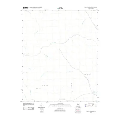
2010 Map of Arroyo Empedrado
USGS Topo · Published 2010About this map
Mesa San Luis dominates the southeastern quadrant of this 2010 landscape, a high plateau defined by steep escarpments and natural drainages. The area is characterized by an intricate network of arroyos, including the namesake Arroyo Empedrado and the sweeping curves of Torreon Wash in the west. Human infrastructure is sparse, concentrated primarily along San Luis Rd and County Rd 85, which provide access through this arid New Mexico terrain.
Find a feature on this map
15 named features on this map. Tap any name to fly to it.
Don’t see what you’re looking for? This feature index may not catch every label — zoom into the map to look around manually.
Map Details
Editions of this 2010 Arroyo Empedrado Map
This is the sole edition of this map. No revisions or reprints were ever made.
Other maps of this area

1883 · Mt. Taylor
USGS Topo · 1:250,000

1886 · Mt. Taylor
USGS Topo · 1:250,000

1892 · Mt. Taylor
USGS Topo · 1:250,000

1899 · Mt. Taylor
USGS Topo · 1:250,000

1958 · Albuquerque
USGS Topo · 1:250,000
1961 · Headcut Reservoir
USGS Topo · 1:24,000

1961 · Cerro Parido
USGS Topo · 1:24,000

1961 · Arroyo Empedrado
USGS Topo · 1:24,000
1961 · Canada Calladita
USGS Topo · 1:24,000
1961 · Tinian
USGS Topo · 1:24,000