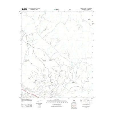
2012 Map of Arroyo Grande NE
USGS Topo · Published 2012About this map
Edna Valley Winery and Corbett Canyon Vineyard anchor the agricultural landscape of this coastal valley region, illustrating the established viticultural presence south of San Luis Obispo. The terrain is defined by a series of branching drainages including W Corral de Piedra Cr and Arroyo Grande Cr, which carve through the hills towards the coast at Grover Beach. These canyons, such as Poorman Canyon and Bee Canyon, show a transition from open ranching and vineyard lands to the residential expansion of Arroyo Grande. In the western hills, the Arroyo Grande Oil Field sits near the small settlement of Tiber, marking the industrial footprint of petroleum extraction alongside the area's more famous agricultural output. The northeastern corner is dominated by the waters of Lopez Reservoir and the rising slopes of Bald Mountain.
Find a feature on this map
120 named features on this map. Tap any name to fly to it.
Don’t see what you’re looking for? This feature index may not catch every label — zoom into the map to look around manually.
Map Details
Editions of this 2012 Arroyo Grande NE Map
This is the sole edition of this map. No revisions or reprints were ever made.
Other maps of this area

1897 · San Luis Obispo
USGS Topo · 1:62,500

1897 · Arroyo Grande
USGS Topo · 1:62,500

1900 · San Luis
USGS Topo · 1:125,000

1922 · Pozo
USGS Topo · 1:62,500

1922 · Nipomo
USGS Topo · 1:62,500

1942 · San Luis Obispo
USGS Topo · 1:62,500

1942 · Arroyo Grande
USGS Topo · 1:62,500

1947 · San Luis Obispo
USGS Topo · 1:250,000

1948 · San Luis Obispo
USGS Topo · 1:250,000

1952 · Arroyo Grande
USGS Topo · 1:62,500