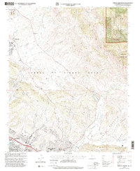
1995 Map of Arroyo Grande NE
USGS Topo · Published 2000About this map
Corral de Piedra Grant and Santa Manuela Grant define the historical land division of this coastal California region during the mid-1990s. The landscape transitions from the suburban edges of Grover Beach and Pismo Beach into the specialized agriculture and oil-producing territory around Edna. Local education is well-represented through institutions such as Independence School, Los Ranchos School, and St Patricks School, while the presence of the Terminal 1055-002 Dam Filtration Plant and several Gravel Pits points to the region's infrastructure and industrial activity.
Find a feature on this map
49 named features on this map. Tap any name to fly to it.
Don’t see what you’re looking for? This feature index may not catch every label — zoom into the map to look around manually.
Map Details
Editions of this 1995 Arroyo Grande NE Map
This is the sole edition of this map. No revisions or reprints were ever made.
Other maps of this area

1897 · San Luis Obispo
USGS Topo · 1:62,500

1897 · Arroyo Grande
USGS Topo · 1:62,500

1900 · San Luis
USGS Topo · 1:125,000

1922 · Pozo
USGS Topo · 1:62,500

1922 · Nipomo
USGS Topo · 1:62,500

1942 · San Luis Obispo
USGS Topo · 1:62,500

1942 · Arroyo Grande
USGS Topo · 1:62,500

1947 · San Luis Obispo
USGS Topo · 1:250,000

1948 · San Luis Obispo
USGS Topo · 1:250,000

1952 · Arroyo Grande
USGS Topo · 1:62,500