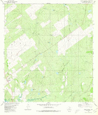
1980 Map of Arroyo Miguel
USGS Topo · Published 1980About this map
The south Texas rangeland of Zapata County is defined here by a network of drainage channels and man-made water catchments crucial for cattle ranching. Settlements like Chihuahua Farm stand out against a landscape shaped by intermittent water sources, such as Arroyo Miguel and Arroyo del Tigre Grande. The abundance of named tanks, including San Antonio Tank, Zacatoso Tank, and Benevides Tank, reveals the reliance on seasonal runoff to sustain livestock in this arid environment.
Find a feature on this map
34 named features on this map. Tap any name to fly to it.
Don’t see what you’re looking for? This feature index may not catch every label — zoom into the map to look around manually.
Map Details
Editions of this 1980 Arroyo Miguel Map
This is the sole edition of this map. No revisions or reprints were ever made.
Other maps of this area

1938 · Falcon
USGS Topo · 1:62,500

1938 · El Sauz
USGS Topo · 1:62,500

1938 · Cuevitas
USGS Topo · 1:62,500

1949 · Mc Allen
USGS Topo · 1:250,000

1954 · McAllen
USGS Topo · 1:250,000

1956 · Arroyo Clareno
USGS Topo · 1:62,500

1957 · Mc Allen
USGS Topo · 1:250,000

1962 · McAllen
USGS Topo · 1:250,000

1965 · Lopeno
USGS Topo · 1:24,000
1965 · Beckwith Arm
USGS Topo · 1:24,000