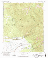
1963 Map of Arroyo Seco
USGS Topo · Published 1975About this map
Antoine Leroux Grant and the Antonio Martinez or Godoi Grant intersect at the high-altitude terrain of the Sangre de Cristo Mountains, where the agricultural traditions of the high desert meet the resources of the Carson National Forest. The landscape is defined by its complex land tenure, featuring Tract C Taos Pueblo and the Tenorio Tract Taos Pueblo. Human activity is concentrated along the river valleys and irrigation systems, such as the Tenorio Ditch, which supports the settlement at Arroyo Seco. Farther north, the University of New Mexico (Lawrence Ranch) sits near Kiowa Village, marking a mid-century academic presence in this traditional ranching area. From the peaks of Lobo Peak and Gallina Peak down to the winding Rio Hondo, the map reveals a system of pack trails and canyons like Yerba Canyon that historically connected these isolated mountain outposts.
Find a feature on this map
47 named features on this map. Tap any name to fly to it.
Don’t see what you’re looking for? This feature index may not catch every label — zoom into the map to look around manually.
Map Details
Editions of this 1963 Arroyo Seco Map
2 editions found
Other maps of this area

1954 · Raton
USGS Topo · 1:250,000

1958 · Raton
USGS Topo · 1:250,000

1963 · Wheeler Peak
USGS Topo · 1:24,000

1963 · Arroyo Seco
USGS Topo · 1:24,000

1963 · Arroyo Hondo
USGS Topo · 1:24,000

1963 · Questa
USGS Topo · 1:24,000

1963 · Guadalupe Mountain
USGS Topo · 1:24,000

1963 · Red River
USGS Topo · 1:24,000

1964 · Los Cordovas
USGS Topo · 1:24,000

1964 · Taos
USGS Topo · 1:24,000