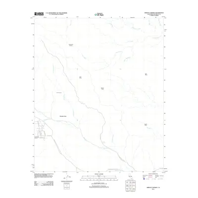
2012 Map of Arroyo Tapiado
USGS Topo · Published 2012About this map
The Great Southern Overland Stage Route of 1849 cuts through this arid landscape, following the corridor of Vallecito Creek and the Old Overland Stage Route. This corridor was once a vital artery for nineteenth-century travelers and gold seekers, and it remains a central geographical feature of the region. The map highlights a series of significant washes and canyons, including Sandstone Canyon and the winding Fish Creek Wash, which drain the tablelands of Middle Mesa, West Mesa, and East Mesa. In the southwest corner, the small settlement of Canebrake Canyon provides a modern point of reference near Mesquite Oasis, while the topography to the north reveals the stark relief of the View of Badland. This modern survey documents the continued use of historical transit paths amidst the shifting sands of numerous washes like Mollusk Wash and Arroyo Tapiado.
Find a feature on this map
32 named features on this map. Tap any name to fly to it.
Don’t see what you’re looking for? This feature index may not catch every label — zoom into the map to look around manually.
Map Details
Editions of this 2012 Arroyo Tapiado Map
This is the sole edition of this map. No revisions or reprints were ever made.
Other maps of this area

1931 · Vallecito
USGS Topo · 1:125,000

1931 · Carrizo
USGS Topo · 1:125,000

1939 · Borrego
USGS Topo · 1:62,500

1942 · Barrel Spring
USGS Topo · 1:62,500

1942 · Borego
USGS Topo · 1:62,500

1942 · Carrizo Mtn
USGS Topo · 1:62,500

1942 · Cuyapaipe
USGS Topo · 1:62,500

1943 · Vallecito
USGS Topo · 1:125,000

1947 · Santa Ana
USGS Topo · 1:250,000
1947 · Barrel Spring
USGS Topo · 1:62,500