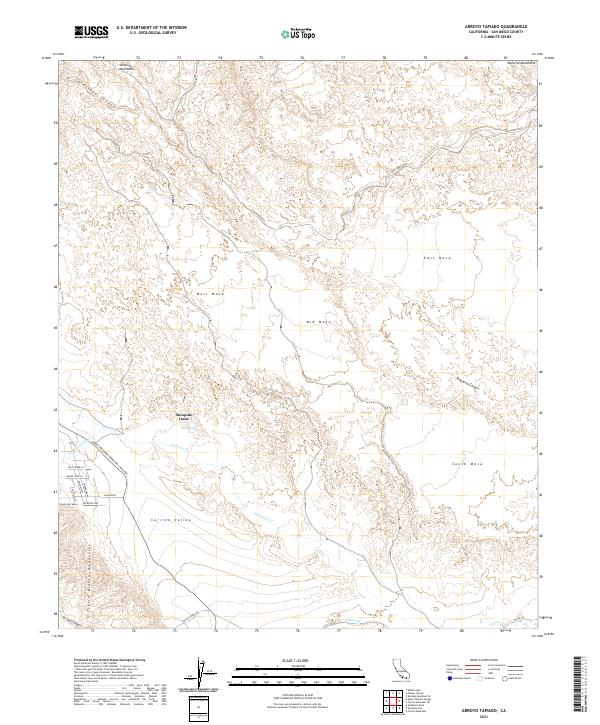
2021 Map of Arroyo Tapiado
USGS Topo · Published 2021About this map
Great Southern Overland Stage Rte traces a historic transportation corridor through this arid landscape, passing south of the Mesquite Oasis and Palm Spring. The terrain is defined by a series of prominent elevated benches including West Mesa, Mid Mesa, and East Mesa, which are dissected by numerous drainages such as Fish Creek Wash and Deguynos Canyon. To the southwest, the Tierra Blanca Mountains rise sharply above Carrizo Valley, while the Vallecito Mountains frame the northern reaches of the sheet. The drainage network is particularly intricate here, with Vallecito Cr and Canebrake Wash converging near the western boundary. This map captures the intersection of early desert transit routes and the natural water sources, like Palm Spring, that once dictated the movement of travelers through the region.
Find a feature on this map
34 named features on this map. Tap any name to fly to it.
Don’t see what you’re looking for? This feature index may not catch every label — zoom into the map to look around manually.
Map Details
Editions of this 2021 Arroyo Tapiado Map
This is the sole edition of this map. No revisions or reprints were ever made.
Other maps of this area

1931 · Vallecito
USGS Topo · 1:125,000

1931 · Carrizo
USGS Topo · 1:125,000

1939 · Borrego
USGS Topo · 1:62,500

1942 · Barrel Spring
USGS Topo · 1:62,500

1942 · Borego
USGS Topo · 1:62,500

1942 · Carrizo Mtn
USGS Topo · 1:62,500

1942 · Cuyapaipe
USGS Topo · 1:62,500

1943 · Vallecito
USGS Topo · 1:125,000

1947 · Santa Ana
USGS Topo · 1:250,000
1947 · Barrel Spring
USGS Topo · 1:62,500