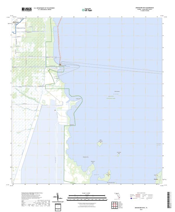
2024 Map of Arsenicker Keys
USGS Topo · Published 2024About this map
Biscayne National Park dominates this coastal landscape where the mainland's engineered canal systems meet the open waters of Biscayne Bay. Along the western edge, the massive footprint of the Homestead Air Reserve Base interfaces with a grid of suburban streets and agricultural drainage, including the Military Canal and Mowry Canal. This transition from military installation to protected marine wilderness is defined by a rugged shoreline featuring Turkey Point and Turtle Point. Further east into the bay, the map documents the Arsenicker Key archipelago, including Long Arsenicker Key and East Arsenicker Key. These keys, along with Totten Key near the settlement of Islandia, mark the boundary between the inner bay and the Intracoastal Waterway, illustrating the intersection of modern South Florida infrastructure and sensitive subtropical environments.
Find a feature on this map
46 named features on this map. Tap any name to fly to it.
Don’t see what you’re looking for? This feature index may not catch every label — zoom into the map to look around manually.
Map Details
Editions of this 2024 Arsenicker Keys Map
This is the sole edition of this map. No revisions or reprints were ever made.
Other maps of this area

1948 · Soldier Key
USGS Topo · 1:24,000

1949 · Elliott Key
USGS Topo · 1:24,000

1949 · Card Sound
USGS Topo · 1:24,000

1949 · Pacific Reef
USGS Topo · 1:24,000

1949 · Arsenicker Keys
USGS Topo · 1:24,000

1949 · Goulds
USGS Topo · 1:24,000

1949 · Perrine
USGS Topo · 1:24,000

1950 · Homestead
USGS Topo · 1:24,000

1950 · Glades
USGS Topo · 1:24,000

1956 · Goulds
USGS Topo · 1:24,000