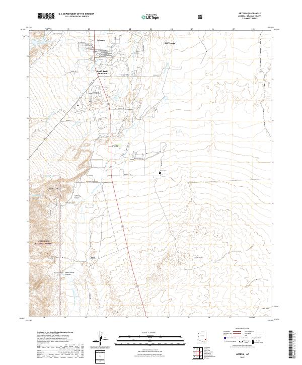
2021 Map of Artesia
USGS Topo · Published 2021About this map
The high desert landscape of Artesia and Lebanon unfolds at the foot of the Pinaleño Mountains. This modern survey illustrates the residential growth north of the Coronado National Forest boundary, where a network of local roads like W Roadrunner St and Yavapai Dr serves the communities of Swift Trail Junction and Lebanon. Water management is a defining characteristic of this arid environment, evidenced by the presence of Lebanon Reservoir Number Two and the numerous drainages that channel seasonal runoff, including the broad Stockton Wash and Marijilda Wash. To the west, the terrain rises sharply toward Metate Peak, where steep canyons such as Lefthand Canyon, Spring Canyon, and Dutch Henry Canyon cut through the forest foothills. Local history and genealogy researchers will find the Artesia Cemetery recorded east of the main settlement along E Artesia Rd.
Find a feature on this map
49 named features on this map. Tap any name to fly to it.
Don’t see what you’re looking for? This feature index may not catch every label — zoom into the map to look around manually.
Map Details
Editions of this 2021 Artesia Map
This is the sole edition of this map. No revisions or reprints were ever made.
Other maps of this area

1942 · Mt. Graham
USGS Topo · 1:62,500

1945 · Mt. Graham
USGS Topo · 1:62,500

1954 · Silver City
USGS Topo · 1:250,000

1958 · Silver City
USGS Topo · 1:250,000

1960 · Thatcher
USGS Topo · 1:62,500

1960 · Safford
USGS Topo · 1:62,500

1962 · Silver City
USGS Topo · 1:250,000
1966 · Tanque
USGS Topo · 1:24,000
1966 · Artesia NE
USGS Topo · 1:24,000

1966 · Artesia
USGS Topo · 1:24,000