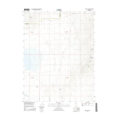
2014 Map of Artesia Lake
USGS Topo · Published 2014About this map
Artesia Lake sits at the heart of this Great Basin landscape, situated within a broad basin bounded by the Buckskin Range to the northwest and the Singatse Range to the east. The terrain transitions from the salt-crusted basin floor of the lake into the fertile reaches of Smith Valley in the southwest. Water resources are central to the geography here, with the Perrin Reservoir and the presence of Delphi Springs indicating the critical importance of moisture in this arid environment.
Find a feature on this map
21 named features on this map. Tap any name to fly to it.
Don’t see what you’re looking for? This feature index may not catch every label — zoom into the map to look around manually.
Map Details
Editions of this 2014 Artesia Lake Map
This is the sole edition of this map. No revisions or reprints were ever made.
Other maps of this area

1891 · Wabuska
USGS Topo · 1:125,000

1891 · Wellington
USGS Topo · 1:125,000

1893 · Wellington
USGS Topo · 1:125,000

1894 · Wabuska
USGS Topo · 1:125,000

1948 · Walker Lake
USGS Topo · 1:250,000

1957 · Walker Lake
USGS Topo · 1:250,000

1957 · Wellington
USGS Topo · 1:62,500

1957 · Como
USGS Topo · 1:62,500

1957 · Wabuska
USGS Topo · 1:62,500

1957 · Yerington
USGS Topo · 1:62,500