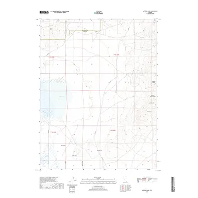
2018 Map of Artesia Lake
USGS Topo · Published 2018About this map
Smith Valley occupies the southern reaches of this landscape, where the rural character of Lyon County is defined by agricultural drainage into Perrin Reservoir. The terrain transitions sharply to the north and east into the arid heights of the Buckskin Range and the Singatse Range. A prominent basin feature, Artesia Lake, sits near the center of the sheet, surrounded by a sparse network of local roads including Burke Rd and Delphi Rd. These routes trace the paths between seasonal water sources like Delphi Springs and topographic crossings such as Nordyke Pass. The eastern edge is marked by steep canyons, notably Western Nevada Canyon and Sand Canyon, which cut through the high desert ridges. The boundary between Douglas and Lyon counties is clearly delineated across the northern uplands, highlighting the jurisdictional divide in this high-elevation basin-and-range environment.
Find a feature on this map
22 named features on this map. Tap any name to fly to it.
Don’t see what you’re looking for? This feature index may not catch every label — zoom into the map to look around manually.
Map Details
Editions of this 2018 Artesia Lake Map
This is the sole edition of this map. No revisions or reprints were ever made.
Other maps of this area

1891 · Wabuska
USGS Topo · 1:125,000

1891 · Wellington
USGS Topo · 1:125,000

1893 · Wellington
USGS Topo · 1:125,000

1894 · Wabuska
USGS Topo · 1:125,000

1948 · Walker Lake
USGS Topo · 1:250,000

1957 · Walker Lake
USGS Topo · 1:250,000

1957 · Wellington
USGS Topo · 1:62,500

1957 · Como
USGS Topo · 1:62,500

1957 · Wabuska
USGS Topo · 1:62,500

1957 · Yerington
USGS Topo · 1:62,500