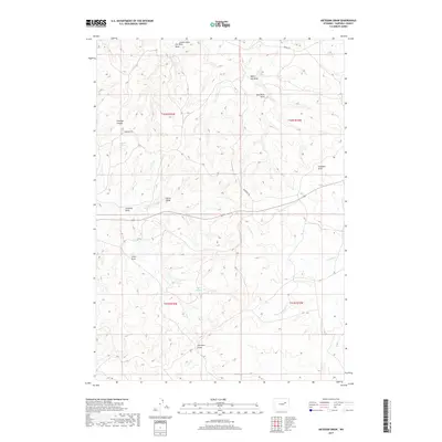
2017 Map of Artesian Draw
USGS Topo · Published 2017About this map
Bozeman Trl cuts across this high plains landscape of Campbell County, following a historic migration route that once brought travelers through the Wyoming territory. The terrain is defined by a dense network of seasonal drainages, including Artesian Draw, Davis Draw, and Collins Draw, which underscore the scarcity of permanent water in this part of the Powder River Basin. Vital water sources such as Emigrant Spring, Von Burg Spring, and Taylor Spring provided essential stopping points for early pioneers and ranchers. The geography is further articulated by named canyons and draws like Fletcher Canyon and Negro Joe Draw, reflecting the local history and the naming of landmarks by those who worked this range. Headwaters for Ninemile Cr and its S Fork Ninemile Cr also begin their descent here, shaping the subtle but complex topography.
Find a feature on this map
21 named features on this map. Tap any name to fly to it.
Don’t see what you’re looking for? This feature index may not catch every label — zoom into the map to look around manually.
Map Details
Editions of this 2017 Artesian Draw Map
This is the sole edition of this map. No revisions or reprints were ever made.
Other maps of this area

1953 · Dry Fork Ranch
USGS Topo · 1:24,000

1953 · South Butte
USGS Topo · 1:24,000

1953 · Rolling Pin Ranch
USGS Topo · 1:24,000

1954 · Artesian Draw
USGS Topo · 1:24,000

1954 · Pine Tree
USGS Topo · 1:24,000

1954 · Taylor Ranch
USGS Topo · 1:24,000

1955 · Newcastle
USGS Topo · 1:250,000

1955 · Arminto
USGS Topo · 1:250,000

1958 · Arminto
USGS Topo · 1:250,000

1958 · Newcastle
USGS Topo · 1:250,000