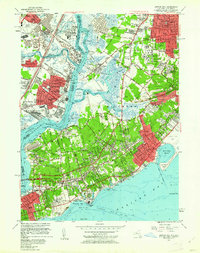
1955 Map of Arthur Kill
USGS Topo · Published 1962About this map
Industrial developments and coastal communities define the landscape along the Arthur Kill in the mid-1950s, where the maritime border between New Jersey and New York is heavily shaped by shipping and manufacturing. The New Jersey side is dominated by the sprawling oil and chemical infrastructure at Linden, Grasselli, and Chrome, alongside the Linden Airport and the US Military Reservation Raritan Arsenal. Across the water on Staten Island, the character shifts toward large institutional grounds and growing residential neighborhoods, including the extensive Willowbrook State School and the Farm Colony.
Find a feature on this map
113 named features on this map. Tap any name to fly to it.
Don’t see what you’re looking for? This feature index may not catch every label — zoom into the map to look around manually.
Map Details
Editions of this 1955 Arthur Kill Map
2 editions found
Other maps of this area

1888 · Plainfield
USGS Topo · 1:62,500

1888 · New Brunswick
USGS Topo · 1:62,500

1888 · Sandy Hook
USGS Topo · 1:62,500

1893 · New Brunswick
USGS Topo · 1:62,500

1893 · Plainfield
USGS Topo · 1:62,500

1893 · Sandy Hook
USGS Topo · 1:62,500

1898 · Plainfield
USGS Topo · 1:62,500

1898 · Staten Island
USGS Topo · 1:62,500

1900 · Passaic
USGS Topo · 1:125,000

1900 · Staten Island
USGS Topo · 1:62,500