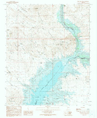
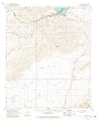
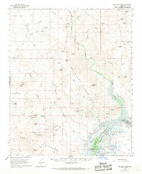
1990 Map of Artillery Peak
USGS Topo · Published 1990About this map
The Artillery Mountains dominate this desert landscape, defined by a legacy of mineral exploration and the convergence of three major watercourses. In the late twentieth century, the confluence of the Big Sandy River and the Santa Maria River forms the Bill Williams River, which feeds into the expansive Alamo Lake. This reservoir sits at the heart of the Alamo Lake State Park, where local history is marked by a small Cem and the settlement of Bullard.
Find a feature on this map
37 named features on this map. Tap any name to fly to it.
Don’t see what you’re looking for? This feature index may not catch every label — zoom into the map to look around manually.
Map Details
Editions of this 1990 Artillery Peak Map
This is the sole edition of this map. No revisions or reprints were ever made.
Other maps of this area

1923 · Signal
USGS Topo · 1:250,000

1942 · Signal
USGS Topo · 1:250,000

1950 · Prescott
USGS Topo · 1:250,000

1954 · Prescott
USGS Topo · 1:250,000

1958 · Prescott
USGS Topo · 1:250,000

1959 · Prescott
USGS Topo · 1:250,000

1960 · Prescott
USGS Topo · 1:250,000

1965 · Prescott
USGS Topo · 1:250,000
1966 · Ives Peak
USGS Topo · 1:62,500
1966 · Artillery Peak
USGS Topo · 1:62,500