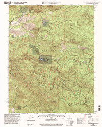
2001 Map of Ascension Mountain
USGS Topo · Published 2004About this map
Jones Meadow and the seasonal activities at Camp Tawonga anchor this high-country survey of the Sierra Nevada foothills at the turn of the millennium. The landscape is defined by the deep incisions of the Middle Fork Tuolumne River and South Fork Tuolumne River, which carve through the Stanislaus National Forest near the western boundary of Yosemite National Park. The map documents a transition from extractive industry to recreational and residential use, noting a Sawmill Quarry and several mineral prospects alongside a Mobile Home Park at Harden Flat.
Find a feature on this map
26 named features on this map. Tap any name to fly to it.
Don’t see what you’re looking for? This feature index may not catch every label — zoom into the map to look around manually.
Map Details
Editions of this 2001 Ascension Mountain Map
2 editions found
Other maps of this area

1893 · Sonora
USGS Topo · 1:125,000

1896 · Sonora
USGS Topo · 1:125,000

1897 · Sonora
USGS Topo · 1:125,000

1897 · Yosemite
USGS Topo · 1:125,000

1898 · Sonora
USGS Topo · 1:125,000

1900 · Yosemite
USGS Topo · 1:125,000

1903 · Yosemite
USGS Topo · 1:125,000

1909 · Yosemite
USGS Topo · 1:125,000

1947 · El Portal
USGS Topo · 1:24,000

1947 · San Jose
USGS Topo · 1:250,000