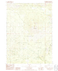
1986 Map of Ash Creek Butte
USGS Topo · Published 1986About this map
The high volcanic terrain of the southern Cascade Range is defined here by the prominent Ash Creek Butte and Sugar Pine Butte. This mid-1980s survey captures a wilderness landscape managed by the Klamath National Forest and Shasta National Forest, where the topography is shaped by complex drainage systems. Water sources are vital features of this high-elevation area, ranging from the secluded Surprise Lake to the broad Harts Meadow. A network of creeks, including Ash Creek, Brewer Creek, and Cold Creek, flow from the volcanic slopes, while specific landmarks like Junction Spring indicate essential water points. The map records the National Forest Boundary and evidence of local resource use, such as a Gravel Pit, amidst the numerous smaller peaks like Fons Butte.
Find a feature on this map
16 named features on this map. Tap any name to fly to it.
Don’t see what you’re looking for? This feature index may not catch every label — zoom into the map to look around manually.
Map Details
Editions of this 1986 Ash Creek Butte Map
This is the sole edition of this map. No revisions or reprints were ever made.
Other maps of this area

1886 · Modoc Lava Bed
USGS Topo · 1:250,000

1886 · Shasta
USGS Topo · 1:250,000

1892 · Modoc Lava-Bed
USGS Topo · 1:250,000

1894 · Shasta
USGS Topo · 1:250,000

1932 · Bartle
USGS Topo · 1:96,000

1934 · Macdoel
USGS Topo · 1:96,000

1935 · Dunsmuir
USGS Topo · 1:125,000

1939 · Bartle
USGS Topo · 1:125,000

1941 · Macdoel
USGS Topo · 1:125,000

1948 · Weed
USGS Topo · 1:250,000