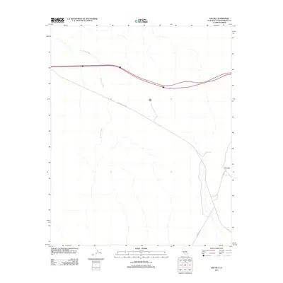
2012 Map of Ash Hill
USGS Topo · Published 2012About this map
Ash Hill and the surrounding Mojave desert floor are defined by the convergence of modern and historic transportation corridors in this 2012 study. The terrain is marked by the prominent landform of Ash Hill itself, which rises above the branching drainage patterns of Broadwell Wash. This area of San Bernardino County preserves the path of the legendary National Trails Hwy, the precursor to Route 66, as it snakes through the arid landscape toward the settlement of Klondike. The map illustrates how drainage features and simple roadways like Klondike Rd navigate the desert floor, providing a detailed look at the infrastructure required to traverse this part of the California interior during the early 21st century.
Find a feature on this map
6 named features on this map. Tap any name to fly to it.
Don’t see what you’re looking for? This feature index may not catch every label — zoom into the map to look around manually.
Map Details
Editions of this 2012 Ash Hill Map
This is the sole edition of this map. No revisions or reprints were ever made.
Other maps of this area

1942 · Amboy
USGS Topo · 1:250,000

1943 · Amboy
USGS Topo · 1:250,000

1953 · San Bernardino
USGS Topo · 1:250,000

1954 · Needles
USGS Topo · 1:250,000

1954 · Bagdad SW
USGS Topo · 1:24,000

1954 · Ludlow SE
USGS Topo · 1:24,000

1955 · Ludlow
USGS Topo · 1:24,000

1955 · Morgans Well
USGS Topo · 1:24,000

1955 · Ash Hill
USGS Topo · 1:24,000

1955 · Broadwell Lake
USGS Topo · 1:62,500