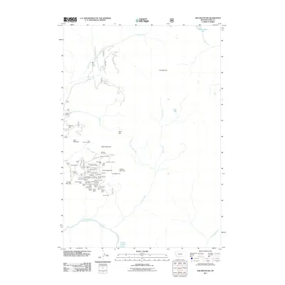
2011 Map of Ash Mountain
USGS Topo · Published 2011About this map
The rugged drainage basin of Crevice Creek and its tributaries dominates this section of Park County, where the legacy of hard-rock mining is etched into the landscape. High-elevation extraction sites congregate around Crevice Mountain and Bald Mountain, including a dense cluster of claims such as the Helldorado Mine, Vindicator Mine, and the Yale-McGinty Mine. This area illustrates a significant industrial footprint in a remote mountainous environment, with mine names like the Sin Nombre Mine and Pop Incline Mine hinting at the diverse prospecting history of the region.
Find a feature on this map
67 named features on this map. Tap any name to fly to it.
Don’t see what you’re looking for? This feature index may not catch every label — zoom into the map to look around manually.
Map Details
Editions of this 2011 Ash Mountain Map
This is the sole edition of this map. No revisions or reprints were ever made.
Other maps of this area

1885 · Gallatin
USGS Topo · 1:125,000

1885 · Gallatin
USGS Topo · 1:125,000

1886 · Canyon
USGS Topo · 1:125,000

1891 · Livingston
USGS Topo · 1:250,000

1893 · Livingston
USGS Topo · 1:250,000

1895 · Canyon
USGS Topo · 1:125,000

1896 · Canyon
USGS Topo · 1:125,000

1901 · Canyon
USGS Topo · 1:125,000

1901 · Gallatin
USGS Topo · 1:125,000

1907 · Canyon
USGS Topo · 1:125,000