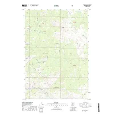
2020 Map of Ash Mountain
USGS Topo · Published 2020About this map
Jardine sits on the western edge of this Montana landscape, where the town's history is tied to the slopes of Mineral Hill. The southern portion of the map is defined by the Black Canyon of the Yellowstone, a dramatic geological feature where the Yellowstone River flows past landmarks like Knowles Falls. This area marks a significant boundary between the Gallatin National Forest and Yellowstone National Park, illustrating the transition from managed forest lands to the protected wilderness of the nation's first national park. High-elevation peaks such as Ash Mtn, Palmer Mtn, and Crevice Mtn overlook a network of backcountry paths, including the Yellowstone River Trail, Crevice Station Tr, and Crevice Creek Trail. For those tracing local history, the Jardine Cem provides a tangible link to the early residents of this high-altitude mining and ranching region.
Find a feature on this map
42 named features on this map. Tap any name to fly to it.
Don’t see what you’re looking for? This feature index may not catch every label — zoom into the map to look around manually.
Map Details
Editions of this 2020 Ash Mountain Map
This is the sole edition of this map. No revisions or reprints were ever made.
Other maps of this area

1885 · Gallatin
USGS Topo · 1:125,000

1885 · Gallatin
USGS Topo · 1:125,000

1886 · Canyon
USGS Topo · 1:125,000

1891 · Livingston
USGS Topo · 1:250,000

1893 · Livingston
USGS Topo · 1:250,000

1895 · Canyon
USGS Topo · 1:125,000

1896 · Canyon
USGS Topo · 1:125,000

1901 · Canyon
USGS Topo · 1:125,000

1901 · Gallatin
USGS Topo · 1:125,000

1907 · Canyon
USGS Topo · 1:125,000