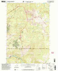
2000 Map of Ash Mountain
USGS Topo · Published 2005About this map
Ash Mountain towers over a landscape defined by the intersection of high wilderness and industrial prospecting at the turn of the millennium. The southern boundary of the Gallatin National Forest meets the northern edge of Yellowstone National Park, with the Absaroka Beartooth Wilderness carving through the center. This survey records the heavy imprint of mineral exploration on the mountain slopes, notably near Mineral Hill and Crevice Mountain, where numerous prospects, an adit, and a mine shaft indicate a history of seeking ore in the backcountry. Farther south, the terrain drops dramatically into the Canyon of the Yellowstone River, where Knowles Falls marks a significant point on the Yellowstone River. The presence of the Timber Camp and Crevice Station suggests the infrastructure required to manage these protected lands and their resources.
Find a feature on this map
38 named features on this map. Tap any name to fly to it.
Don’t see what you’re looking for? This feature index may not catch every label — zoom into the map to look around manually.
Map Details
Editions of this 2000 Ash Mountain Map
This is the sole edition of this map. No revisions or reprints were ever made.
Other maps of this area

1885 · Gallatin
USGS Topo · 1:125,000

1885 · Gallatin
USGS Topo · 1:125,000

1886 · Canyon
USGS Topo · 1:125,000

1891 · Livingston
USGS Topo · 1:250,000

1893 · Livingston
USGS Topo · 1:250,000

1895 · Canyon
USGS Topo · 1:125,000

1896 · Canyon
USGS Topo · 1:125,000

1901 · Canyon
USGS Topo · 1:125,000

1901 · Gallatin
USGS Topo · 1:125,000

1907 · Canyon
USGS Topo · 1:125,000