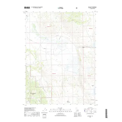
2018 Map of Ash Valley
USGS Topo · Published 2018About this map
Ash Valley defines the central topography of this northeastern California landscape, where high-altitude wetlands and seasonal drainages converge. The 2018 survey reveals a landscape largely shaped by ranching and public land management, with the southwestern corner falling within the Modoc National Forest. Transportation is defined by a network of ranch and access roads, including Ash Valley Rd and the specifically named P Bar T Ranch Rd, which navigate the elevation changes between Knox Mtn and Anderson Mtn. Water remains the most critical resource for this high desert environment, evidenced by the strategic locations of Fleming Spring, Diaz Spring, and Fulstone Spring. These water sources and the surrounding terrain of Sagebrush Flat illustrate the enduring utility of the land for grazing and watershed protection.
Find a feature on this map
21 named features on this map. Tap any name to fly to it.
Don’t see what you’re looking for? This feature index may not catch every label — zoom into the map to look around manually.
Map Details
Editions of this 2018 Ash Valley Map
This is the sole edition of this map. No revisions or reprints were ever made.
Other maps of this area

1886 · Alturas
USGS Topo · 1:250,000

1886 · Honey Lake
USGS Topo · 1:250,000

1891 · Honey Lake
USGS Topo · 1:250,000

1892 · Alturas
USGS Topo · 1:250,000

1893 · Honey Lake
USGS Topo · 1:250,000

1954 · Grasshopper Valley
USGS Topo · 1:62,500

1954 · Alturas
USGS Topo · 1:250,000

1955 · Westwood
USGS Topo · 1:250,000

1956 · Hayden Hill
USGS Topo · 1:62,500

1958 · Alturas
USGS Topo · 1:250,000