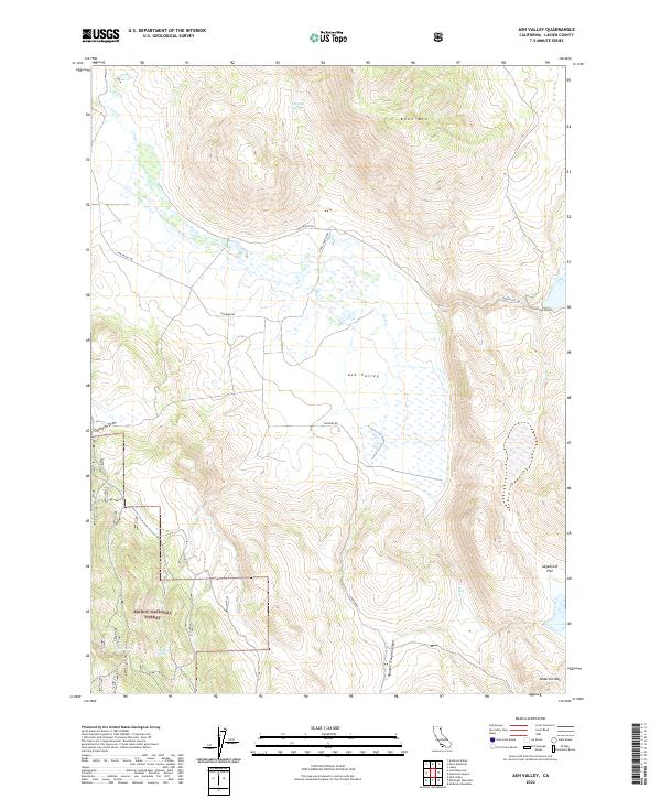
2022 Map of Ash Valley
USGS Topo · Published 2022About this map
Ash Valley defines this high-desert landscape in Lassen County, where drainage networks like Ash Cr and Spooner Trough Canyon carve through the basin. The map illustrates a remote corner of the Modoc National Forest, characterized by significant peaks such as Knox Mtn and Anderson Mtn. For those tracing local landmarks or water sources, the terrain is marked by several named springs, including Fleming Spring, Diaz Spring, and Filstone Spring. Transportation is limited to a sparse network of ranch roads, such as Ash Valley Rd and P Bar T Ranch Rd, which reflect the area's continued reliance on livestock and seasonal access. The presence of Sagebrush Flat and Oxendine Draw further emphasizes the specialized geographic vocabulary of this northeastern California interior.
Find a feature on this map
19 named features on this map. Tap any name to fly to it.
Don’t see what you’re looking for? This feature index may not catch every label — zoom into the map to look around manually.
Map Details
Editions of this 2022 Ash Valley Map
This is the sole edition of this map. No revisions or reprints were ever made.
Other maps of this area

1886 · Alturas
USGS Topo · 1:250,000

1886 · Honey Lake
USGS Topo · 1:250,000

1891 · Honey Lake
USGS Topo · 1:250,000

1892 · Alturas
USGS Topo · 1:250,000

1893 · Honey Lake
USGS Topo · 1:250,000

1954 · Grasshopper Valley
USGS Topo · 1:62,500

1954 · Alturas
USGS Topo · 1:250,000

1955 · Westwood
USGS Topo · 1:250,000

1956 · Hayden Hill
USGS Topo · 1:62,500

1958 · Alturas
USGS Topo · 1:250,000