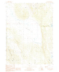
1990 Map of Ash Valley
USGS Topo · Published 1990About this map
Ash Valley defines this portion of northeastern California, where the high-elevation flats are irrigated by Ash Creek and numerous family-named springs. In 1990, the landscape remained characterized by ranching and resource extraction, with features like Fleming Sheep Camp and several Borrow Pits and a Gravel Pit scattered across the basin. The southern and western reaches of the sheet are dominated by the elevations of the Modoc National Forest, containing named peaks like Knox Mountain and Anderson Mountain.
Find a feature on this map
19 named features on this map. Tap any name to fly to it.
Don’t see what you’re looking for? This feature index may not catch every label — zoom into the map to look around manually.
Map Details
Editions of this 1990 Ash Valley Map
This is the sole edition of this map. No revisions or reprints were ever made.
Other maps of this area

1886 · Alturas
USGS Topo · 1:250,000

1886 · Honey Lake
USGS Topo · 1:250,000

1891 · Honey Lake
USGS Topo · 1:250,000

1892 · Alturas
USGS Topo · 1:250,000

1893 · Honey Lake
USGS Topo · 1:250,000

1954 · Grasshopper Valley
USGS Topo · 1:62,500

1954 · Alturas
USGS Topo · 1:250,000

1955 · Westwood
USGS Topo · 1:250,000

1956 · Hayden Hill
USGS Topo · 1:62,500

1958 · Alturas
USGS Topo · 1:250,000