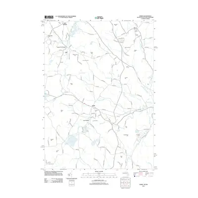
2012 Map of Ashby
USGS Topo · Published 2012About this map
Ashby and its surrounding villages sit at a convergence of North Central Massachusetts and Southern New Hampshire, where the upland terrain is marked by numerous family-named hills and vital water resources. The landscape is defined by its reservoirs, including the Ashby Reservoir and Fitchburg Reservoir, which support the regional water infrastructure. Small communities like South Village, Smithville, and Gibson Four Corners are connected by a network of country roads that bypass significant elevations such as Watatic Pond and Jewell Hill. Local heritage is preserved in scattered burial grounds like Glenwood Cem and Prospect Hill Cem, which anchor the historical record of these townships. Recreational and agricultural identities are evident through sites like Camp Middlesex, Camp Kirby, and the curiously named Sleeping Monk Farm, reflecting a modern era that balances conservation with rural development.
Find a feature on this map
139 named features on this map. Tap any name to fly to it.
Don’t see what you’re looking for? This feature index may not catch every label — zoom into the map to look around manually.
Map Details
Editions of this 2012 Ashby Map
This is the sole edition of this map. No revisions or reprints were ever made.
Other maps of this area

1887 · Fitchburg
USGS Topo · 1:62,500

1889 · Fitchburg
USGS Topo · 1:62,500

1893 · Fitchburg
USGS Topo · 1:62,500

1893 · Groton
USGS Topo · 1:62,500

1900 · Peterboro
USGS Topo · 1:62,500

1906 · Milford
USGS Topo · 1:62,500

1931 · Groton
USGS Topo · 1:48,000

1931 · Fitchburg
USGS Topo · 1:48,000

1935 · Groton
USGS Topo · 1:62,500

1935 · Fitchburg
USGS Topo · 1:62,500