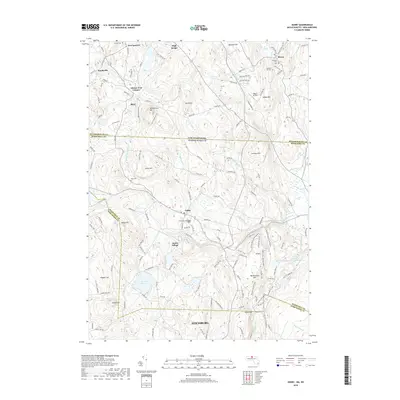
2018 Map of Ashby
USGS Topo · Published 2018About this map
The hills of northern Worcester County and southern Hillsborough County define this landscape, where the town of Ashby serves as a central hub. From the southern reaches of Fitchburg to the New Hampshire settlements of New Ipswich and Mason, the map reveals a pattern of historic development following the river valleys and mountain gaps. The Souhegan River and Willard Brook cut through a series of named peaks including Blood Hill, Jewell Hill, and Watatic Pond. Local history and genealogy are anchored by several burying grounds such as Glenwood Cem and Prospect Hill Cem. Significant landmarks like High Bridge and the Mason Airfield appear alongside natural features like The Whirlpool and Wright Ponds, illustrating the long-standing integration of small-scale industry and community life within the upland terrain of the Massachusetts-New Hampshire border.
Find a feature on this map
144 named features on this map. Tap any name to fly to it.
Don’t see what you’re looking for? This feature index may not catch every label — zoom into the map to look around manually.
Map Details
Editions of this 2018 Ashby Map
This is the sole edition of this map. No revisions or reprints were ever made.
Other maps of this area

1887 · Fitchburg
USGS Topo · 1:62,500

1889 · Fitchburg
USGS Topo · 1:62,500

1893 · Fitchburg
USGS Topo · 1:62,500

1893 · Groton
USGS Topo · 1:62,500

1900 · Peterboro
USGS Topo · 1:62,500

1906 · Milford
USGS Topo · 1:62,500

1931 · Groton
USGS Topo · 1:48,000

1931 · Fitchburg
USGS Topo · 1:48,000

1935 · Groton
USGS Topo · 1:62,500

1935 · Fitchburg
USGS Topo · 1:62,500