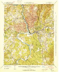
1943 Map of Asheville
USGS Topo · Published 1951About this map
The French Broad River and Swannanoa River converge at the heart of this mid-century survey, defining the industrial and social topography of the area. The landscape is characterized by the planned residential patterns of Biltmore Forest and the institutional grounds of Highland Hospital and the Eliada Orphans Home. High-elevation landmarks like Patton Mtn and Sunset Mtn overlook the urban core, where prominent civic structures like the Court House City Hall and Auditorium anchor the downtown grid.
Find a feature on this map
105 named features on this map. Tap any name to fly to it.
Don’t see what you’re looking for? This feature index may not catch every label — zoom into the map to look around manually.
Map Details
Editions of this 1943 Asheville Map
2 editions found
Other maps of this area

1894 · Asheville
USGS Topo · 1:125,000

1900 · Mount Mitchell
USGS Topo · 1:125,000

1901 · Asheville
USGS Topo · 1:125,000

1902 · Mount Mitchell
USGS Topo · 1:125,000

1905 · Pisgah
USGS Topo · 1:125,000

1906 · Pisgah
USGS Topo · 1:125,000

1907 · Saluda
USGS Topo · 1:125,000

1935 · Craggy Pinnacle
USGS Topo · 1:24,000

1936 · Enka
USGS Topo · 1:24,000

1936 · Weaverville
USGS Topo · 1:24,000