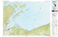
1989 Map of Ashland
USGS Topo · Published 1989About this map
Lake Superior dominates the northern reaches of this 1989 study, where the Apostle Islands National Lakeshore archipelago stretches across the water. On the mainland, the regional centers of Ashland and Washburn anchor the western shore of Chequamegon Bay, with Northland College established in the heart of Ashland. The landscape transitions from the protected forests of the Bad River Indian Reservation to the industrial and transport hubs of Ironwood and Bessemer along the state border.
Find a feature on this map
126 named features on this map. Tap any name to fly to it.
Don’t see what you’re looking for? This feature index may not catch every label — zoom into the map to look around manually.
Map Details
Editions of this 1989 Ashland Map
This is the sole edition of this map. No revisions or reprints were ever made.
Other maps of this area

1940 · Upson
USGS Topo · 1:48,000

1941 · Bayfield
USGS Topo · 1:48,000

1942 · Ashland
USGS Topo · 1:48,000

1942 · Mellen
USGS Topo · 1:48,000

1942 · Marengo
USGS Topo · 1:48,000

1943 · Little Girls Point
USGS Topo · 1:24,000

1943 · Upson
USGS Topo · 1:48,000

1943 · Ironwood
USGS Topo · 1:48,000

1943 · Little Girl Point
USGS Topo · 1:48,000

1943 · Odanah
USGS Topo · 1:48,000