1964 Map of Ashland
USGS Topo · Published 1973About this map
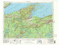
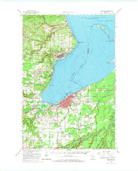
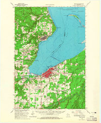
Lake Superior dominates the northern reaches of this mid-1960s study, where the curving spit of Long Island and Chequamegon Point shelter the deep waters of Chequamegon Bay. On the western shore, the town of Washburn is mapped in detail alongside remnants of local industry, including a Quarry and Sandpit. To the south, the city of Ashland serves as a regional hub, defined by the convergence of the Chicago and North Western and Northern Pacific railroads. The map reveals a landscape transitioning from the maritime activity of the South Channel to the agricultural and academic pursuits at the University of Wis Experiment Sta and County Teachers Coll. Notable for genealogists, several distinct burial grounds are clustered south of the city, including St Agnes Cem, Calvary Cem, and B'Nai Israel Cem, reflecting the diverse cultural fabric of the Chequamegon Bay communities during this era.
Find a feature on this map
73 named features on this map. Tap any name to fly to it.
Don’t see what you’re looking for? This feature index may not catch every label — zoom into the map to look around manually.
Map Details
Editions of this 1964 Ashland Map
2 editions found
Historical Maps of Ashland Through Time
6 maps found