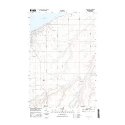
2015 Map of Ashland East
USGS Topo · Published 2015About this map
Ashland serves as the focal point for this survey, situated on the south shore of Chequamegon Bay where the city's street grid meets Lake Superior. The map details the transition from the developed urban corridors of Main St and Ellis Ave S to the educational grounds of Northland Coll. Beyond the city limits, the landscape is defined by an intricate network of waterways draining toward the bay. The eponymous White River flows through the southern half of the quadrangle, joined by numerous tributaries including Rock Cr and Deer Cr. To the east, the topography becomes dominated by complex wetlands and sloughs, most notably Wood Cr Slough and the winding course of the Kakagon River, illustrating the ecological character of this coastal Wisconsin region. Rural life is traced through named corridors like Odanah Rd and Huhn Rd as they navigate the forest and marshlands.
Find a feature on this map
86 named features on this map. Tap any name to fly to it.
Don’t see what you’re looking for? This feature index may not catch every label — zoom into the map to look around manually.
Map Details
Editions of this 2015 Ashland East Map
This is the sole edition of this map. No revisions or reprints were ever made.
Other maps of this area

1942 · Ashland
USGS Topo · 1:48,000

1942 · Mellen
USGS Topo · 1:48,000

1942 · Marengo
USGS Topo · 1:48,000

1943 · Odanah
USGS Topo · 1:48,000

1945 · Odanah
USGS Topo · 1:48,000

1945 · Marengo
USGS Topo · 1:48,000

1945 · Mellen
USGS Topo · 1:48,000

1947 · Ashland
USGS Topo · 1:48,000

1953 · Ashland
USGS Topo · 1:250,000

1958 · Ashland
USGS Topo · 1:250,000