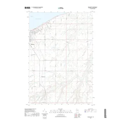
2018 Map of Ashland East
USGS Topo · Published 2018About this map
Lake Superior and its south-shore Chequamegon Bay dominate the northern edge of this Wisconsin landscape, where the eastern reaches of Ashland meet a complex network of waterways. The town's grid, including Prentice Ave and Ellis Ave S, gives way to industrial developments along Rail Dr and the extensive marshlands of Wood Cr Slough. Southward, the terrain transitions into a more rural pattern centered around the settlement of White River, where the river itself meanders through low-lying ground alongside Rack Cr and Deer Cr. The map shows a clear distinction between the structured urban expansion near the bay and the preservation of natural drainage systems like Bishigokwe Cr and the Kakagon River to the east. Local history is etched into the road names, from Old Airport Rd to family-named routes such as Hegstrom Rd and Harju Rd, marking the generational footprint of this lakeshore community.
Find a feature on this map
77 named features on this map. Tap any name to fly to it.
Don’t see what you’re looking for? This feature index may not catch every label — zoom into the map to look around manually.
Map Details
Editions of this 2018 Ashland East Map
This is the sole edition of this map. No revisions or reprints were ever made.
Other maps of this area

1942 · Ashland
USGS Topo · 1:48,000

1942 · Mellen
USGS Topo · 1:48,000

1942 · Marengo
USGS Topo · 1:48,000

1943 · Odanah
USGS Topo · 1:48,000

1945 · Odanah
USGS Topo · 1:48,000

1945 · Marengo
USGS Topo · 1:48,000

1945 · Mellen
USGS Topo · 1:48,000

1947 · Ashland
USGS Topo · 1:48,000

1953 · Ashland
USGS Topo · 1:250,000

1958 · Ashland
USGS Topo · 1:250,000