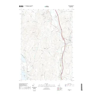
2021 Map of Ashland
USGS Topo · Published 2021About this map
The Pemigewasset River carves a deep valley through this portion of New Hampshire, serving as the primary corridor for the towns of Plymouth and Ashland. This landscape is defined by the sharp contrast between the river basin and the surrounding peaks, such as Plymouth Mtn and Bridgewater Mtn. To the west, the map details the northeastern reach of Newfound Lake at Pasquaney Bay, a notable water feature that has long influenced local recreation and settlement patterns. The smaller community of Bridgewater is situated near these shores, connected to the interior by a network of rural roads. Genealogists and local historians will find value in the precise locations of historic burial grounds, including Whittemores Cem and Webster Cem, which reflect the area's early agricultural and village roots before modern infrastructure changed the valley's character.
Find a feature on this map
102 named features on this map. Tap any name to fly to it.
Don’t see what you’re looking for? This feature index may not catch every label — zoom into the map to look around manually.
Map Details
Editions of this 2021 Ashland Map
This is the sole edition of this map. No revisions or reprints were ever made.
Other maps of this area

1925 · Holderness
USGS Topo · 1:62,500

1927 · Holderness
USGS Topo · 1:62,500

1927 · Cardigan
USGS Topo · 1:62,500

1928 · Plymouth
USGS Topo · 1:62,500

1928 · Rumney
USGS Topo · 1:62,500

1930 · Cardigan
USGS Topo · 1:62,500

1931 · Plymouth
USGS Topo · 1:62,500

1932 · Rumney
USGS Topo · 1:62,500

1949 · Portland
USGS Topo · 1:250,000

1956 · Cardigan
USGS Topo · 1:62,500