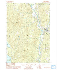
1987 Map of Ashland
USGS Topo · Published 1987About this map
The Pemigewasset River serves as the central artery for this part of New Hampshire, carving a valley that separates the mountainous terrain of Plymouth and Bridgewater from the eastern foothills. The town of Ashland is the primary center of activity, situated where the river bends near the northern edge of the Scribner-Fellows State Forest. This 1987 provisional survey captures the region just before significant modern development, showing a landscape defined by its complex hydrology, with numerous smaller flows like Glove Hollow Brook and Clay Brook feeding the main river system.
Find a feature on this map
40 named features on this map. Tap any name to fly to it.
Don’t see what you’re looking for? This feature index may not catch every label — zoom into the map to look around manually.
Map Details
Editions of this 1987 Ashland Map
This is the sole edition of this map. No revisions or reprints were ever made.
Other maps of this area

1925 · Holderness
USGS Topo · 1:62,500

1927 · Holderness
USGS Topo · 1:62,500

1927 · Cardigan
USGS Topo · 1:62,500

1928 · Plymouth
USGS Topo · 1:62,500

1928 · Rumney
USGS Topo · 1:62,500

1930 · Cardigan
USGS Topo · 1:62,500

1931 · Plymouth
USGS Topo · 1:62,500

1932 · Rumney
USGS Topo · 1:62,500

1949 · Portland
USGS Topo · 1:250,000

1956 · Cardigan
USGS Topo · 1:62,500