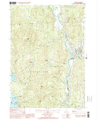
2000 Map of Ashland
USGS Topo · Published 2001About this map
Pemigewasset River flows through the heart of this landscape, marking the boundary between Grafton and Belknap counties at the turn of the 21st century. The village of Ashland serves as the primary population center, situated near the confluence of the Squam River and the main channel. To the west, the terrain rises sharply toward Plymouth Mountain and Bridgewater Mountain, where numerous brooks like Glove Hollow Brook and Whittemore Brook drain the high country. The map captures the infrastructure of the era, from the Sewage Disposal Ponds and Gaging Sta near the river to the Scribner-Fellows State Forest and its accompanying trail. Evidence of local industry and recreation is present in the several sandpits, a Golf Course, and the clustered developments along the eastern shore of Newfound Lake at Pasquaney Bay.
Find a feature on this map
48 named features on this map. Tap any name to fly to it.
Don’t see what you’re looking for? This feature index may not catch every label — zoom into the map to look around manually.
Map Details
Editions of this 2000 Ashland Map
This is the sole edition of this map. No revisions or reprints were ever made.
Other maps of this area

1925 · Holderness
USGS Topo · 1:62,500

1927 · Holderness
USGS Topo · 1:62,500

1927 · Cardigan
USGS Topo · 1:62,500

1928 · Plymouth
USGS Topo · 1:62,500

1928 · Rumney
USGS Topo · 1:62,500

1930 · Cardigan
USGS Topo · 1:62,500

1931 · Plymouth
USGS Topo · 1:62,500

1932 · Rumney
USGS Topo · 1:62,500

1949 · Portland
USGS Topo · 1:250,000

1956 · Cardigan
USGS Topo · 1:62,500