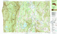
1987 Map of Ashley Falls
USGS Topo · Published 1987About this map
Sheffield and the surrounding tri-state highlands are documented in this late-1980s topographic study, capturing the intersection of the Berkshires and Litchfield Hills. The Housatonic River snakes through the central valley, flanked by established villages like Ashley Falls and Weatogue. High elevations to the west are dominated by the Mount Washington State Forest and the Mt Everett Reservation, where the Appalachian Trail traverses prominent peaks including Mt Everett and Mt Frissell.
Find a feature on this map
97 named features on this map. Tap any name to fly to it.
Don’t see what you’re looking for? This feature index may not catch every label — zoom into the map to look around manually.
Map Details
Editions of this 1987 Ashley Falls Map
2 editions found
Other maps of this area

1885 · Sheffield
USGS Topo · 1:62,500

1888 · Sheffield
USGS Topo · 1:62,500

1888 · Sandisfield
USGS Topo · 1:62,500

1891 · Sheffield
USGS Topo · 1:62,500

1892 · Winsted
USGS Topo · 1:62,500

1892 · Cornwall
USGS Topo · 1:62,500

1893 · Sheffield
USGS Topo · 1:62,500

1893 · Cornwall
USGS Topo · 1:62,500

1893 · Sandisfield
USGS Topo · 1:62,500

1897 · Sandisfield
USGS Topo · 1:62,500