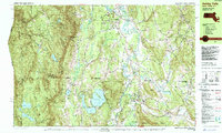
1987 Map of Ashley Falls
USGS Topo · Published 1987About this map
Mount Everett dominates the western skyline of this tri-state boundary region where Massachusetts, Connecticut, and New York meet. The 1980s landscape is defined by the winding Housatonic River and a string of traditional valley settlements including Sheffield, Ashley Falls, and Canaan. The mapping captures a network of rural hamlets like Joyceville and Hammertown, alongside significant water bodies such as Washining Lake and Washinee Lake, known collectively as the Twin Lakes.
Find a feature on this map
116 named features on this map. Tap any name to fly to it.
Don’t see what you’re looking for? This feature index may not catch every label — zoom into the map to look around manually.
Map Details
Editions of this 1987 Ashley Falls Map
2 editions found
Other maps of this area

1885 · Sheffield
USGS Topo · 1:62,500

1888 · Sheffield
USGS Topo · 1:62,500

1888 · Sandisfield
USGS Topo · 1:62,500

1891 · Sheffield
USGS Topo · 1:62,500

1892 · Winsted
USGS Topo · 1:62,500

1892 · Cornwall
USGS Topo · 1:62,500

1893 · Sheffield
USGS Topo · 1:62,500

1893 · Cornwall
USGS Topo · 1:62,500

1893 · Sandisfield
USGS Topo · 1:62,500

1897 · Sandisfield
USGS Topo · 1:62,500