Loading...
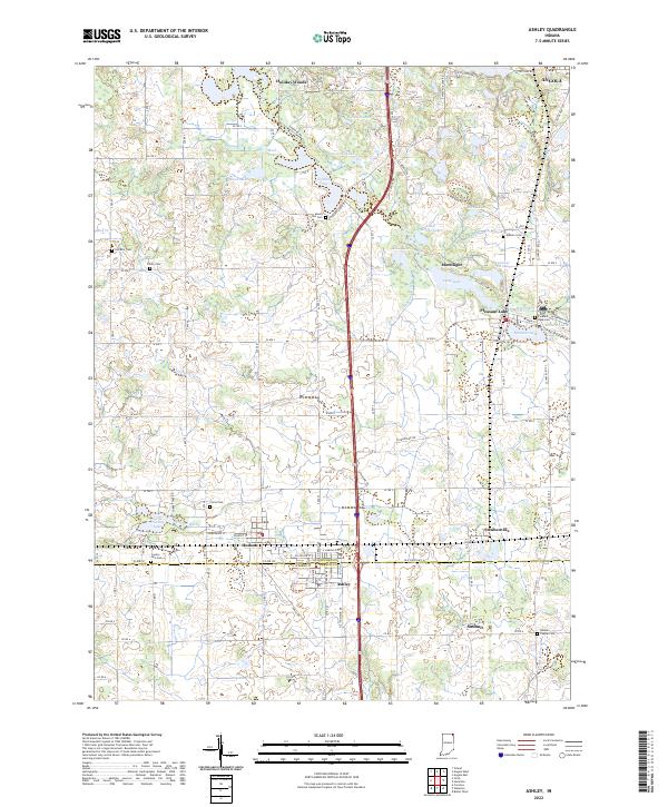
Loading map...2022 Map of Ashley
USGS Topo · Published 2022About this map
Ashley and Hudson anchor this 2022 survey along the border of Steuben and DeKalb counties. The landscape is defined by its glacial hydrology, with numerous water bodies like Golden Lake, Johnson Lake, and Long Lake scattered across the township lines of t36n r13e and t37n r13e. This area demonstrates a dense network of early rural burial grounds and small settlements that have persisted into the modern era.
Find a feature on this map
95 named features on this map. Tap any name to fly to it.
Don’t see what you’re looking for? This feature index may not catch every label — zoom into the map to look around manually.
Map Details
Date Portrayed2022
Date Published2022
PublisherU.S. Geological Survey
Map TypeTopographic
Scale1:24000
Physical Dimensions24 x 29 inches
Editions of this 2022 Ashley Map
This is the sole edition of this map. No revisions or reprints were ever made.
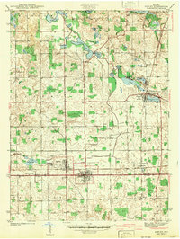
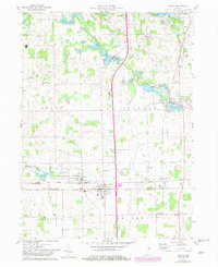
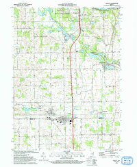
Historical Maps of Pleasant Lake Through Time
4 maps found
Featured Locations
Source Details
SourceU.S. Geological Survey
CopyrightPublic Domain