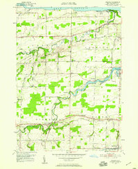
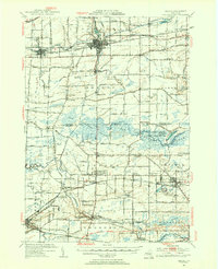
1950 Map of Ashwood
USGS Topo · Published 1959About this map
Oak Orchard Creek winds northward through this agricultural landscape of Orleans County, eventually meeting Lake Ontario near Lakeside. The settlement pattern in the 1950s follows a well-established grid of local roads, such as Stillwater Road and Ridge Road, which connect rural hamlets like Ashwood, Kenyonville, and Waterport. The southern edge of the map is defined by the historic corridor of the Erie Canal near Eagle Harbor, a vital piece of New York's early transportation infrastructure that remains prominent even as the New York Central Railroad bisects the center of the township.
Find a feature on this map
56 named features on this map. Tap any name to fly to it.
Don’t see what you’re looking for? This feature index may not catch every label — zoom into the map to look around manually.
Map Details
Editions of this 1950 Ashwood Map
2 editions found
Other maps of this area

1897 · Albion
USGS Topo · 1:62,500

1897 · Medina
USGS Topo · 1:62,500

1897 · Oak Orchard
USGS Topo · 1:62,500

1897 · Ridgeway
USGS Topo · 1:62,500

1944 · Ashwood
USGS Topo · 1:31,680

1944 · Albion
USGS Topo · 1:31,680

1949 · Kendall
USGS Topo · 1:62,500
1949 · Medina
USGS Topo · 1:24,000
1950 · Knowlesville
USGS Topo · 1:24,000
1950 · Medina
USGS Topo · 1:62,500