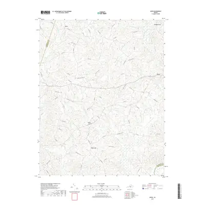
2019 Map of Aspen
USGS Topo · Published 2019About this map
Aspen and Aspenwall sit at the center of this rural Virginia landscape, which transitions toward the Roanoke River valley at its southern edge. The terrain is defined by a dense network of small waterways, including Louise Cr and Cub Cr, that have shaped the winding paths of local roads. The settlement of Phenix serves as a small hub in the east, while Wren and Rough Creek mark the northern reaches. For local historians, the preservation of names like Jordans Gate School Rd and Trents Cemetery Rd points to the area's legacy of family farms and community institutions. The southern boundary follows the natural curve of the Roanoke River where Charlotte Co meets Halifax Co, highlighting the enduring role of river geography in defining local jurisdiction and land use.
Find a feature on this map
66 named features on this map. Tap any name to fly to it.
Don’t see what you’re looking for? This feature index may not catch every label — zoom into the map to look around manually.
Map Details
Editions of this 2019 Aspen Map
This is the sole edition of this map. No revisions or reprints were ever made.
Other maps of this area

1892 · Appomattox
USGS Topo · 1:125,000

1947 · Roanoke
USGS Topo · 1:250,000

1953 · Greensboro
USGS Topo · 1:250,000

1954 · Greensboro
USGS Topo · 1:250,000

1954 · Clover
USGS Topo · 1:62,500

1954 · Halifax
USGS Topo · 1:62,500

1956 · Brookneal
USGS Topo · 1:62,500

1956 · Charlotte Court House
USGS Topo · 1:62,500

1959 · Roanoke
USGS Topo · 1:250,000

1962 · Greensboro
USGS Topo · 1:250,000