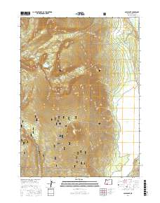
2017 Map of Aspen Lake
USGS Topo · Published 2017About this map
Winema National Forest dominates this landscape, encompassing a high-elevation environment defined by volcanic peaks and alpine basins. The terrain is anchored by the prominent Aspen Butte and Mt Harriman, with the Mountain Lakes Loop trail connecting a series of high-country water bodies including Lake Harriette, Echo Lake, and Storm Lake. To the east, the topography descends sharply toward the shoreline of Aspen Lake, where a network of forest development roads like Nat For Dev Rd 3840 and Nat For Dev Rd 3828 provide access through the Grampian Hills. This survey details the complex drainage systems of the region, where seasonal creeks such as Swan Cr and Bridge Cr feed into the larger lake basin, illustrating the transition from the glaciated peaks of the Wilderness area to the managed timberlands and waterways of the Klamath Basin.
Find a feature on this map
37 named features on this map. Tap any name to fly to it.
Don’t see what you’re looking for? This feature index may not catch every label — zoom into the map to look around manually.
Map Details
Editions of this 2017 Aspen Lake Map
This is the sole edition of this map. No revisions or reprints were ever made.
Other maps of this area

1889 · Klamath
USGS Topo · 1:250,000

1891 · Ashland
USGS Topo · 1:250,000

1893 · Ashland
USGS Topo · 1:250,000

1894 · Klamath
USGS Topo · 1:250,000

1897 · Ashland
USGS Topo · 1:250,000

1955 · Lake O' Woods
USGS Topo · 1:62,500

1955 · Surveyor Mtn
USGS Topo · 1:62,500

1955 · Klamath Falls
USGS Topo · 1:250,000

1955 · Medford
USGS Topo · 1:250,000

1957 · Medford
USGS Topo · 1:250,000