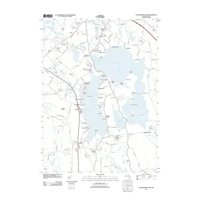
2012 Map of Assawompset Pond
USGS Topo · Published 2012About this map
Assawompset Pond dominates the landscape of this Massachusetts interior, surrounded by a complex network of smaller water bodies including Long Pond and Great Quittacas Pond. The settlement pattern in Lakeville and surrounding areas like North Rochester and East Freetown is defined by a series of clustered lakeside communities such as Nelsons Grove, Buena Vista Shores, and Hilltop Acres. These developments trace the irregular shorelines of the region’s massive ponds, emphasizing the area's transition from agricultural roots to a modern residential and recreational character.
Find a feature on this map
208 named features on this map. Tap any name to fly to it.
Don’t see what you’re looking for? This feature index may not catch every label — zoom into the map to look around manually.
Map Details
Editions of this 2012 Assawompset Pond Map
This is the sole edition of this map. No revisions or reprints were ever made.
Other maps of this area

1885 · New Bedford
USGS Topo · 1:62,500

1885 · Middleboro
USGS Topo · 1:62,500

1885 · Taunton
USGS Topo · 1:62,500

1888 · New Bedford
USGS Topo · 1:62,500

1888 · Fall River
USGS Topo · 1:62,500

1888 · Taunton
USGS Topo · 1:62,500

1888 · Middleboro
USGS Topo · 1:62,500

1893 · Taunton
USGS Topo · 1:62,500

1893 · Middleboro
USGS Topo · 1:62,500

1893 · Fall River
USGS Topo · 1:62,500