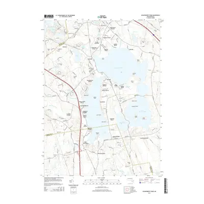
2015 Map of Assawompset Pond
USGS Topo · Published 2015About this map
Assawompset Pond and its interconnected neighbors, Long Pond, Great Quittacas Pond, and Little Quittacas Pond, form a massive freshwater complex at the border of Bristol and Plymouth counties. This 2015 survey shows a landscape defined by waterfront residential clusters and peninsulas, including Bettys Neck and Jeremys Point, alongside many smaller settlements like North Lakeville and East Freetown. The map is particularly useful for genealogical research, identifying numerous family-named burial grounds such as Haskins Cem, Thompson Hill Cem, and Pond Cem. Higher ground is marked by features like King Phillips Lookout and Burial Hill, while the southeastern corner reveals the headwaters of the Acushnet River and the rural transition into North Rochester.
Find a feature on this map
95 named features on this map. Tap any name to fly to it.
Don’t see what you’re looking for? This feature index may not catch every label — zoom into the map to look around manually.
Map Details
Editions of this 2015 Assawompset Pond Map
This is the sole edition of this map. No revisions or reprints were ever made.
Other maps of this area

1885 · New Bedford
USGS Topo · 1:62,500

1885 · Middleboro
USGS Topo · 1:62,500

1885 · Taunton
USGS Topo · 1:62,500

1888 · New Bedford
USGS Topo · 1:62,500

1888 · Fall River
USGS Topo · 1:62,500

1888 · Taunton
USGS Topo · 1:62,500

1888 · Middleboro
USGS Topo · 1:62,500

1893 · Taunton
USGS Topo · 1:62,500

1893 · Middleboro
USGS Topo · 1:62,500

1893 · Fall River
USGS Topo · 1:62,500