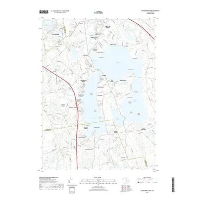
2018 Map of Assawompset Pond
USGS Topo · Published 2018About this map
Assawompset Pond dominates this corner of Plymouth and Bristol Counties, surrounded by a complex network of smaller water bodies and established residential enclaves. The landscape is a mosaic of shores and heights, including Churchill Shores, Nelsons Grove, and Lakeview Heights. This modern survey reveals the dense distribution of local burial grounds that trace family lineages back centuries, such as Haskins Cem, Thompson Hill Cem, and Strowbridge Cem.
Find a feature on this map
216 named features on this map. Tap any name to fly to it.
Don’t see what you’re looking for? This feature index may not catch every label — zoom into the map to look around manually.
Map Details
Editions of this 2018 Assawompset Pond Map
This is the sole edition of this map. No revisions or reprints were ever made.
Other maps of this area

1885 · New Bedford
USGS Topo · 1:62,500

1885 · Middleboro
USGS Topo · 1:62,500

1885 · Taunton
USGS Topo · 1:62,500

1888 · New Bedford
USGS Topo · 1:62,500

1888 · Fall River
USGS Topo · 1:62,500

1888 · Taunton
USGS Topo · 1:62,500

1888 · Middleboro
USGS Topo · 1:62,500

1893 · Taunton
USGS Topo · 1:62,500

1893 · Middleboro
USGS Topo · 1:62,500

1893 · Fall River
USGS Topo · 1:62,500