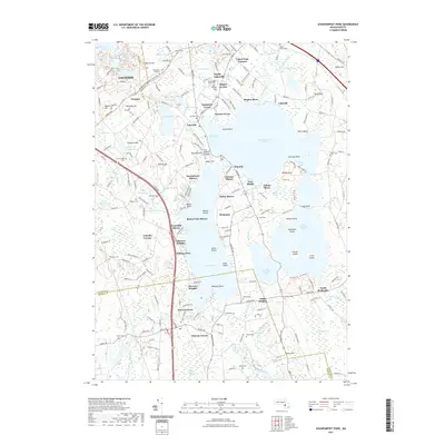
2021 Map of Assawompset Pond
USGS Topo · Published 2021About this map
Assawompset Pond and its neighboring waters dominate this landscape, illustrating the intricate network of glacial lakes and reservoirs in Bristol and Plymouth counties. The map identifies significant historical sites including the Wampanoag Royal Cem and Burial Hill, alongside the elevated King Phillips Lookout near Alden Hill. These features, paired with specialized hydrological sites like the Saint Yves Bog Reservoir, reveal a region defined by its reliance on water resources and a deep preservation of indigenous and early colonial geography. Residential pockets like North Lakeville, East Freetown, and Buena Vista Shores border the larger ponds, while numerous family cemeteries such as Haskins Cem and Ashley Cem are found near old intersections like Staples Corner and Masons Corner.
Find a feature on this map
114 named features on this map. Tap any name to fly to it.
Don’t see what you’re looking for? This feature index may not catch every label — zoom into the map to look around manually.
Map Details
Editions of this 2021 Assawompset Pond Map
This is the sole edition of this map. No revisions or reprints were ever made.
Other maps of this area

1885 · New Bedford
USGS Topo · 1:62,500

1885 · Middleboro
USGS Topo · 1:62,500

1885 · Taunton
USGS Topo · 1:62,500

1888 · New Bedford
USGS Topo · 1:62,500

1888 · Fall River
USGS Topo · 1:62,500

1888 · Taunton
USGS Topo · 1:62,500

1888 · Middleboro
USGS Topo · 1:62,500

1893 · Taunton
USGS Topo · 1:62,500

1893 · Middleboro
USGS Topo · 1:62,500

1893 · Fall River
USGS Topo · 1:62,500