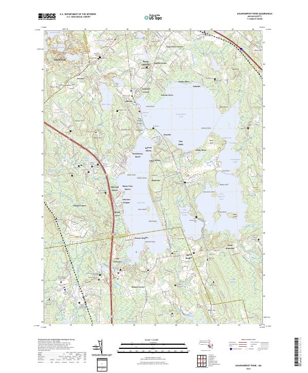
2024 Map of Assawompset Pond
USGS Topo · Published 2024About this map
Assawompset Pond and its neighboring waters, Long Pond and the Great Quittacas Pond, dominate this southeastern Massachusetts landscape along the border of Plymouth and Bristol counties. The shoreline is densely populated with small residential enclaves and summer colonies like Nelsons Grove, Huckleberry Shores, and Buena Vista Shores, reflecting the region's long-standing transition from rural farming to lakeside recreation. Local history is deeply etched into the terrain at King Phillips Lookout and the East Freetown Indian Burial Grounds.
Find a feature on this map
247 named features on this map. Tap any name to fly to it.
Don’t see what you’re looking for? This feature index may not catch every label — zoom into the map to look around manually.
Map Details
Editions of this 2024 Assawompset Pond Map
This is the sole edition of this map. No revisions or reprints were ever made.
Other maps of this area

1885 · New Bedford
USGS Topo · 1:62,500

1885 · Middleboro
USGS Topo · 1:62,500

1885 · Taunton
USGS Topo · 1:62,500

1888 · New Bedford
USGS Topo · 1:62,500

1888 · Fall River
USGS Topo · 1:62,500

1888 · Taunton
USGS Topo · 1:62,500

1888 · Middleboro
USGS Topo · 1:62,500

1893 · Taunton
USGS Topo · 1:62,500

1893 · Middleboro
USGS Topo · 1:62,500

1893 · Fall River
USGS Topo · 1:62,500